Hello.
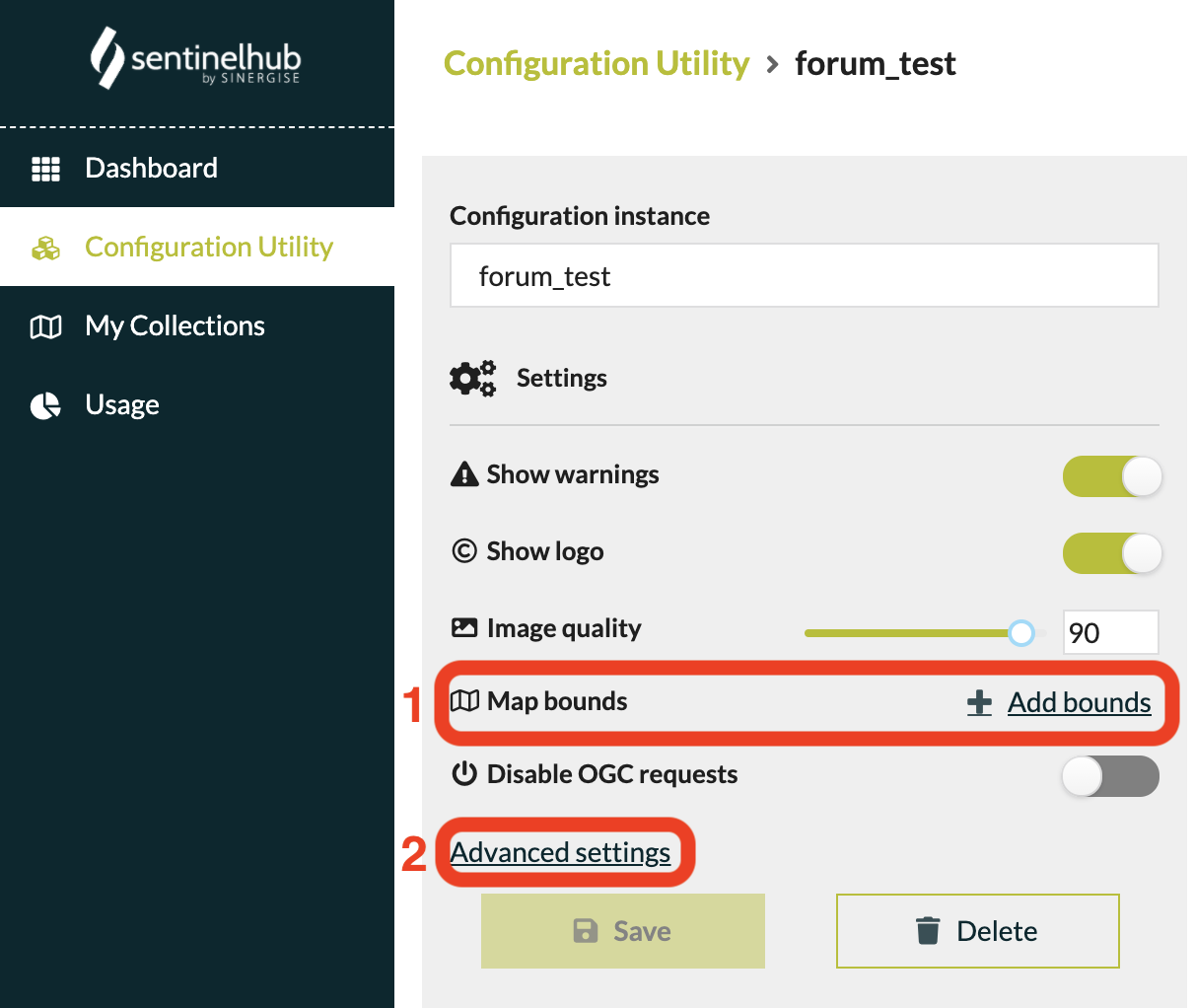
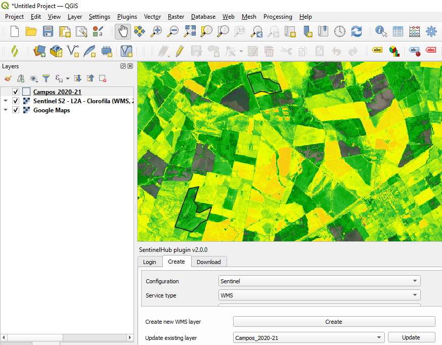
I´m using the QGIS Plugin and I would like to “clip” the visualization created in “Configuration Utility” for the polygons but leave the rest with my base map (Google Maps). How can I do it?

Hello.
I´m using the QGIS Plugin and I would like to “clip” the visualization created in “Configuration Utility” for the polygons but leave the rest with my base map (Google Maps). How can I do it?
No account yet? Create an account
Enter your E-mail address. We'll send you an e-mail with instructions to reset your password.